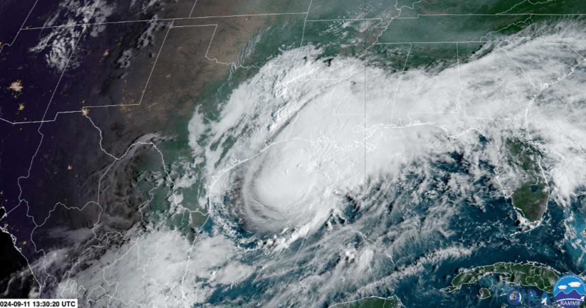
Hurricane Francine CIRA/RAMMB/NOAA
Hurricane Francine is making its presence felt along the Gulf Coast as it tracks toward Louisiana, bringing heavy rainfall and powerful winds. Currently classified as a Category 1 hurricane, Francine is producing sustained winds of 90 mph and its effects are already being felt along the coastline. The center of the storm is located 150 miles southwest of Morgan City, Louisiana and is moving northeast at 13 mph. As the storm nears land, conditions are expected to worsen significantly throughout the day, prompting the National Weather Service in New Orleans to issue a warning for residents to remain sheltered.
Onshore Conditions Deteriorating – Hurricane Francine Updates
The National Hurricane Center reports that the outer bands of Francine are beginning to move onshore, bringing deteriorating weather conditions across the region. The hurricane’s arrival is expected later this afternoon or evening with increasing wind speeds and heavier rainfall as the day progresses. Although the storm is facing some wind shear, which has limited its ability to strengthen further, Francine remains a potent storm capable of causing significant damage. The NHC emphasizes that while the hurricane is likely to make landfall as a Category 1 rather than a Category 2, the associated risks of flooding, storm surge and wind damage are still severe.
Flooding and Storm Surge Risks Persist- New Orleans Hurricane
Despite the slight reduction in intensity, Hurricane Francine remains a serious threat to the Gulf Coast, particularly in Louisiana. The storm’s heavy rains are expected to cause dangerous flooding in low-lying areas, while the storm surge could lead to significant coastal inundation. Residents in the path of the hurricane are advised to stay sheltered through tomorrow morning as the storm moves inland. With its current trajectory and speed, Francine is on a collision course with the Louisiana coast, and emergency services are on high alert as they prepare for the storm’s impact.