image credit-NHC
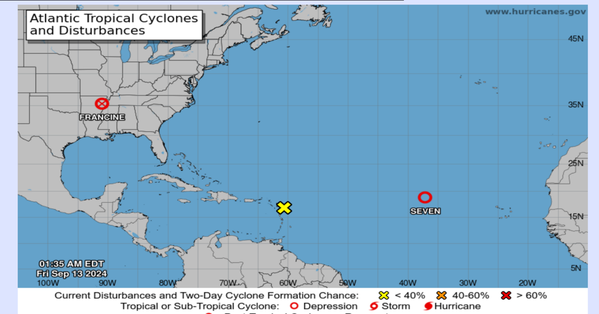
Hurricane Francine, which initially struck Louisiana as a powerful Category 2 storm with 100 mph winds, has now weakened into a post-tropical system as it moves inland. As of the latest advisory from the National Hurricane Center (NHC), the system was about 90 miles south of Memphis, Tennessee with sustained winds of 25 mph, moving north at 9 mph. Despite the storm’s weakening, it has left a trail of destruction in Louisiana, with more than 390,000 power outages reported early Thursday morning, along with an additional 46,000 outages in Mississippi.
Tornado Warnings and Power Outages: The Aftermath in the Gulf Coast
The storm’s trailing bands led to over 10 tornado warnings across the Florida Panhandle, with a tornado watch in effect until 1 p.m. The severe weather caused significant damage, including in New Orleans, where floodwaters nearly submerged a pickup truck, trapping the driver inside. A heroic emergency room nurse, Miles Crawford, waded into waist-high water, smashed the truck’s window with a hammer and rescued the driver. The dramatic rescue was captured live by a local news crew, showcasing the bravery of the community in the face of disaster.
Rescue Efforts and Community Response in Louisiana
Louisiana Governor Jeff Landry has mobilized the National Guard to assist parishes affected by the storm. The Guard is equipped with food, water, nearly 400 high-water vehicles around 100 boats and 50 helicopters for search-and-rescue operations. In Morgan City, residents awoke to assess the damage, with some finding large trees uprooted and homes narrowly avoiding significant damage. The community’s resilience is evident as people like Pamela Miller and Jeffrey Beadle survey the aftermath and begin the process of recovery.
The Atlantic Basin: New Threats on the Horizon
As Francine diminishes, attention shifts to the Atlantic, where Tropical Depression Seven (TD7) continues to churn. Located about 800 miles west-northwest of the Cape Verde Islands, TD7 is forecast to strengthen into Tropical Storm Gordon within the next 48 hours. Additionally, the NHC is monitoring two other systems with potential for development. One system, located east of the Caribbean’s Leeward Islands has a 30% chance of becoming a tropical depression or storm, though dry air may limit its growth. Another system, expected to form off the southeastern U.S. coastline, also has a 30% chance of development in the coming week.
Looking Ahead: The 2024 Atlantic Hurricane Season Continues
As the 2024 Atlantic hurricane season progresses, with peak activity typically occurring between August and October, residents of the Gulf Coast and Atlantic seaboard remain on high alert. The NHC continues to monitor developing systems closely, urging communities to stay informed and prepared for potential threats.